The reading room
Find your way through history. Explore 279 entries across places and centuries. Follow an event, compare its context, and examine the evidence.
Jump to the pictures and stories ↓ Africa Americas Asia Europe Middle East Oceania Global 1200–1600 CE
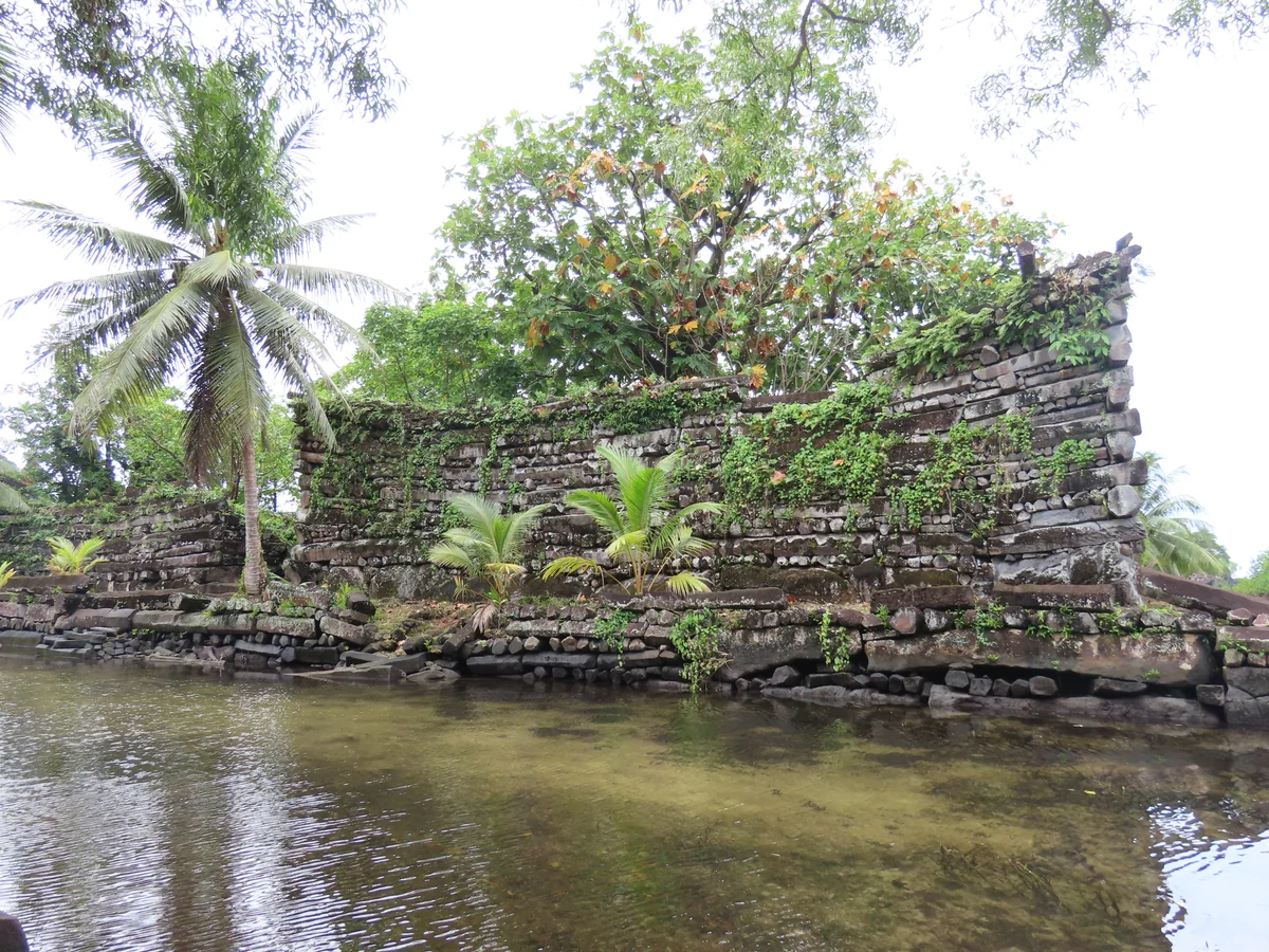
In-depth study Nan Madol and its surroundings on Pohnpei, photographed by Uhooep on 16 May 2023. This is a modern view of surviving structures, not a reconstruction of Saudeleur-period life.Picture source & rights Uhooep / Wikimedia Commons · CC BY-SA 4.0 · Resized and converted to WebP; derivative under the same licence · Licence terms Oceania / Culture
Basalt walls, artificial islets and waterways at Nan Madol reveal a specifically Pohnpeian history of engineering, ceremony and political authority in Micronesia.
Read → 1838 CE
In-depth study Herbert River Native Mounted Police camp, Queensland, c. 1870. The photograph documents personnel and infrastructure of a force central to colonial frontier violence, but it does not show an attack or its victims. Aboriginal and Torres Strait Islander viewers are advised that historical photographs may show people who have died.Picture source & rights Unknown photographer / State Library of Queensland / Wikimedia Commons · Public domain · Full frame retained; resized and converted to WebP · Licence terms Oceania / Empire
The killing of Gamilaraay people at Myall Creek exposes the violence accompanying settler expansion and the exceptional nature of the prosecutions that followed.
Read → 1840 CE
In-depth study The Waitangi sheet of te Tiriti o Waitangi, signed in 1840.Picture source & rights Archives New Zealand, IA9/9 Sheet 1 · CC BY-SA 2.0 · Image unchanged Oceania / Rights
An agreement between Māori rangatira and the British Crown became central to New Zealand’s history. Its Māori and English texts conveyed different understandings of authority.
Read → 1845–1872 CE
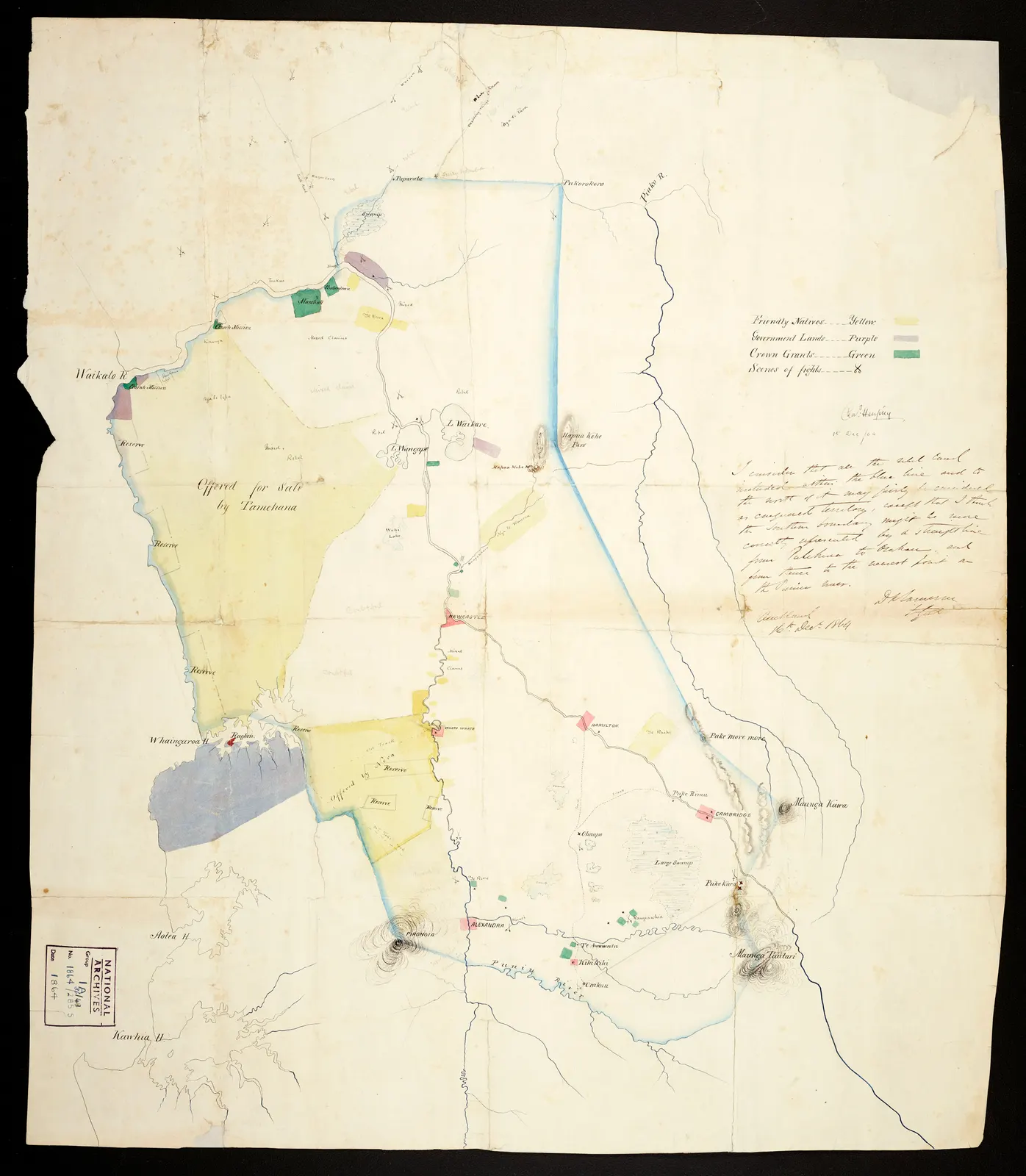
In-depth study An 1864 Waikato land-confiscation map, signed by Charles Heaphy and annotated by General Cameron. A colonial administrative source, not a neutral account of Māori land rights or a modern boundary map.Picture source & rights Archives New Zealand Te Rua Mahara o te Kāwanatanga · ACGO 8368 IA36/8/49 · CC BY 2.0 · Full frame retained; resized and converted to WebP · Licence terms Oceania / War
Wars between Crown forces, Māori opponents and Māori allies of the Crown reshaped authority and landholding across the North Island.
Read → 1874–1970 CE
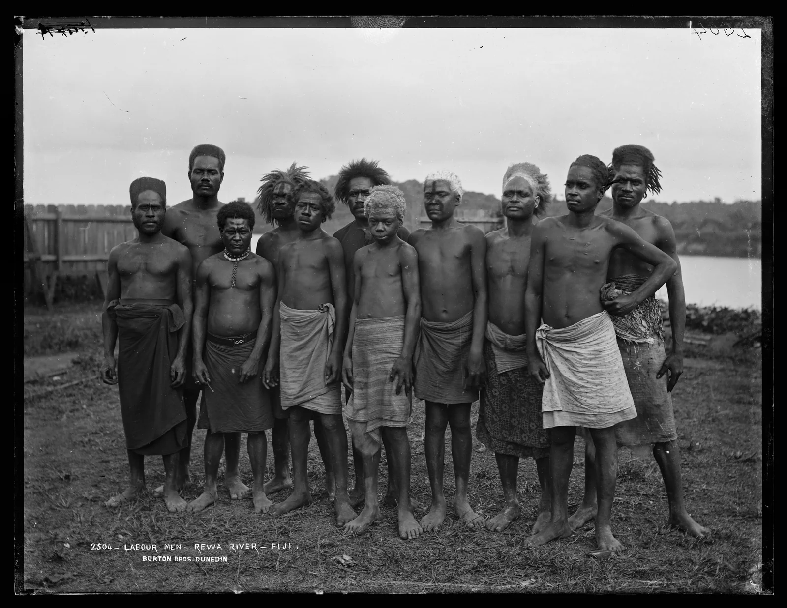
In-depth study Alfred Burton, Labour Men, Rewa River, Fiji, June 1884. Te Papa associates the group with Fijian people; it is not catalogued as Indian indentured migrants. Whole negative frame and inscription retained.Picture source & rights Alfred Burton / Burton Brothers studio / Museum of New Zealand Te Papa Tongarewa · C.017409 · No Known Copyright Restrictions (New Zealand law) · Whole-frame reduced WebP derivative · Licence terms Oceania / Rights
A Rewa River photograph, migration records and constitutional documents connect colonial rule with labour and political representation. This focused chapter distinguishes Indigenous Fijian workers, Indian indentured migrants and the unequal terms of inclusion before and at independence.
Read → 1899–1962 CE
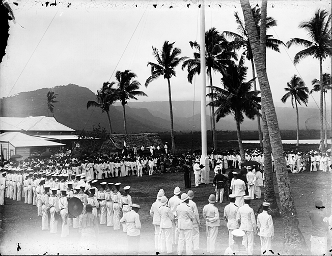
In-depth study Flag-raising at Mulinuʻu, Apia, 1 March 1900. Thomas Andrew’s photograph shows a German colonial ceremony, not the 1929 Mau parade; it cannot establish the participants’ consent.Picture source & rights Thomas Andrew / Museum of New Zealand Te Papa Tongarewa · C.001438 · No Known Copyright Restrictions (New Zealand law) · Unchanged JPEG · Licence terms Oceania / Rights
A colonial photograph, Samoan testimony and constitutional records connect partition, resistance and the independence of Western Samoa. This focused chapter distinguishes changing administrations, women’s organizing and the limits of political inclusion.
Read → 1904–1989 CE
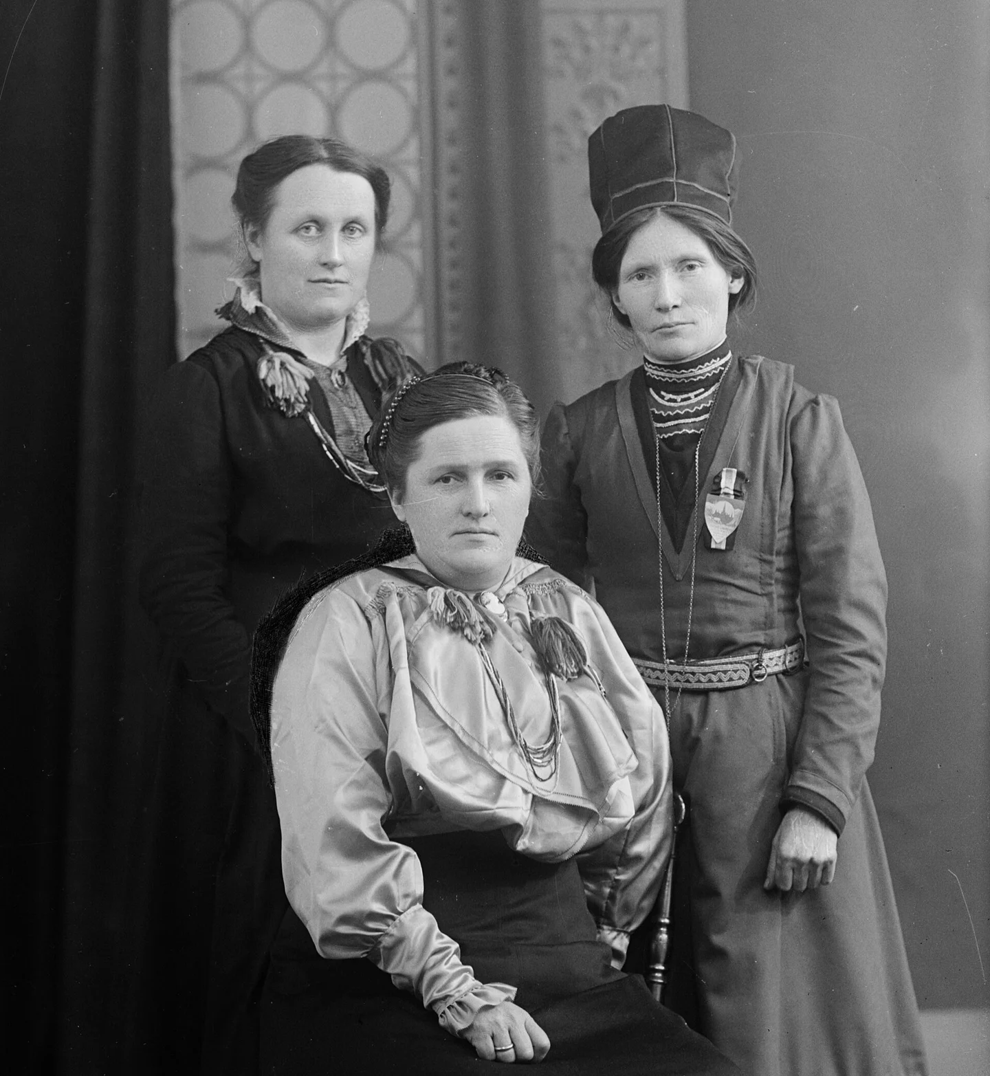
In-depth study Ellen Lie, Anna Löfwander Jarwson and Elsa Laula Renberg, photographed on 3 March 1917. A group portrait, not a photograph of the February congress proceedings.Picture source & rights Hilfling-Rasmussen / NTNU University Library, HI-v-11085_01 · CC BY-SA 4.0 · Resized and converted to WebP; derivative under the same licence · Licence terms Europe / Rights
Sámi history crosses national borders. Women’s organizing, campaigns over land and education, and the Alta conflict connect cultural survival with demands for political representation.
Read → 1946–1958 CE
In-depth study Bikini Islanders unload pandanus for roof thatch at Rongerik after relocation, 7 March 1946. The official military record shows relocation work, not an explosion, radiation injury or consent to permanent exile.Picture source & rights Joint Task Force 1 · Operation Crossroads: The Official Pictorial Record, p. 21 · U.S. government public domain · Wikimedia 500-pixel derivative converted to WebP · Licence terms Oceania / War
U.S. nuclear testing transformed Bikini and Enewetak and exposed Marshallese communities to displacement and radioactive contamination.
Read → 1982–1993 CE
In-depth study A view on Mer (Murray Island), Torres Strait, June 1931. Place context for the later Mabo case—not Eddie Mabo, his property or the 1992 judgment. The exact path is not identified in the source.Picture source & rights Queensland State Archives · Digital Image ID 5769 · Home Secretary’s Office · Public domain · Wikimedia derivative reduced to the original 720-pixel width and converted to WebP · Licence terms Oceania / Rights
Meriam plaintiffs challenged the denial of their landholding. The 1992 Mabo judgment recognised native title and helped reshape Australian land law.
Read →